Kilimanjaro
Rongai Route
Rongai Route
The Rongai route approaches Kilimanjaro from the north, close to the Kenyan border. It is the quietest route on the mountain. The route offers trekkers a relatively un spoilt wilderness experience where it is possible to see large wildlife like antelope, elephant and buffalo.
The North-East side of the mountain is almost a leeward side of the mountain and therefore it gets significantly less moisture than the southern slopes which means that trekkers are less likely to encounter rain. Trekkers are also more likely to get clear, unclouded views of the mountain. The route is mostly recommended for a Kilimanjaro climb during the rainy season in the months of April and May.
This route has one disadvantage that there are no topographical features that allow the ‘climb high / sleep low’ principle to be exploited, even if one incorporates a rest day that features a modest acclimatization excursion.
Rongai Route Over view
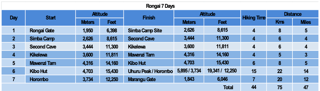
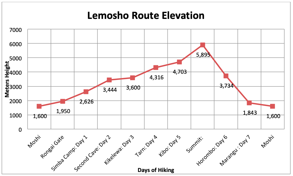
7 Days Rongai Route
DAY 1: Rongai Gate to Simba Camp
Elevation: 6,398 ft / 1,950m to 8,615 ft / 2,626m
Distance: 8 km/5 miles
Hiking Time: 3-4 hours
Habitat: Rain Forest
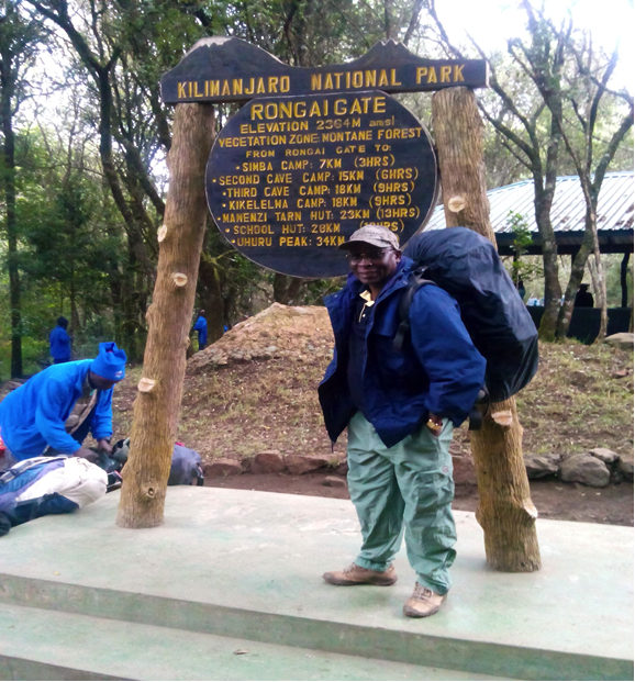
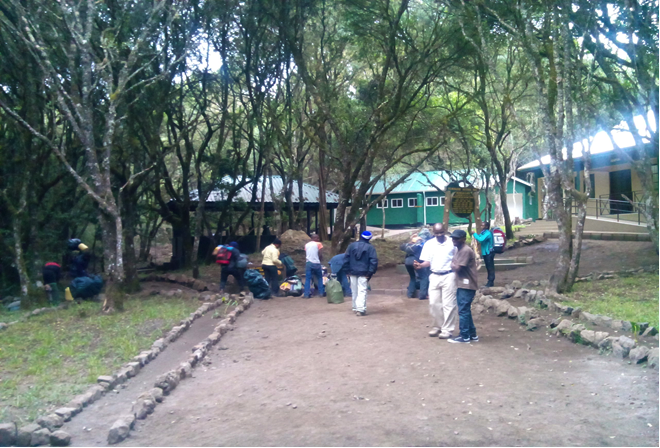
You will drive for about an hour from Moshi to Marangu Gate about 42 kms, the headquarters for the Kilimanjaro National Park, for registration and securing permits. At Marangu gate climbers may as well get time to hire some of the gear which they may have not come with. After that you will be transfer to the Rongai Gate on the North East part of the mountain at the Tanzania / Kenya border. The drive from Marangu Gate to Rongai gate will take about two hours. At the gate you will get opportunity to meet your crew who will assist you on your climb. After formal registration at Rongai Gate you will start to hike gently through the forest to Simba Camp site for dinner and over night.
DAY 2: Simba camp to Second Cave
Elevation: 8615 ft / 2,626m to 11,300 ft / 3,444 m
Distance: 6 km/4 miles
Hiking Time: 3-4 hours
Habitat: Heath
After breakfast you embark on steady ascent up to the Second Cave with superb views of Kibo and the Eastern Ice fields on the crater rim. Others will use this camp for lunch and proceed to Kikelewa. But due to long distance to Kikelewa you will overnight at this camp to avoid straining for hiking over long distance, therefore making your next day hike more comfortable.
DAY 3: Second Cave to Kikelewa Camp
Elevation: 11,300 ft / 3,444 m to 11,811 ft / 3600 m
Distance: 12 km/7 miles
Hiking Time: 8 hours
Habitat: Heather and moorland
You begin this morning with a steady trekking up to Second Cave where you will take your lunch. After lunch you will continue trekking though moorland, finally arriving at Kikelewa Camp. This trekking in this day is more physically demanding than the one in the previous day.
DAY 4: Kikelewa Camp to Mawenzi Tarn Camp
Elevation: 11,811 / 3600 m ft to 14,160 ft / 4316 m
Distance: 5 km/3 miles
Hiking Time: 3-4 hours
Habitat: Alpine Desert
The hike today is short and steep up a grassy slope. Views of the area are stunning. As you exit the moorland zone and emerge into the Alpine Desert zone, the landscape changes dramatically. You will encounter a cool and clear climate and sun shine can be very intense. Your camp is at Mawenzi Tarn which is situated beneath the jagged spires of Mawenzi peak which is steep and spiky and rises to a series of peaks. The remainder of the day can be spent relaxing or exploring the area.
DAY 5: Mawenzi Tarn to Kibo Hut
Elevation: 14,160 / 4316 m ft to 15,430 ft / 4,703 m
Distance: 8 km/5 miles
Hiking Time: 5-6 hours
Habitat: Alpine Desert
You climb gradually, then cross the lunar desert of the “Saddle” between Mawenzi and Kibo. Your camp, Kibo Hut, sits at the bottom of the Kibo crater wall. Once here we rest, enjoy an early dinner to prepare for the summit day.
DAY 6 Summiting Day
Kibo Hut to Uhuru Peak
Elevation: 15,430 ft / 4,703m to 19,341 ft / 5,895 m
Distance: 6 km/4 miles
Hiking Time: 6-8 hours
Habitat: Arctic
Uhuru Peak to Horombo Hut
Elevation: 19,341 ft / 5,895 m to 12,250 ft / 3,734 m
Distance: 16 km/10 miles
Hiking Time: 5-7 hours
Habitat: Heather
Very early in the morning (around midnight), you begin your push to the summit. This is the most mentally and physically challenging portion of the trek. The wind and cold at this elevation and time of day can be extreme. You ascend in the darkness for several hours while taking frequent, but short, breaks. At Gilman’s point (18,652 ft / 5,685m), you will be rewarded with the most magnificent sunrise you are ever likely to see coming over Mawenzi Peak. Finally, you arrive at Uhuru Peak- the highest point on Mount Kilimanjaro and the continent of Africa.
After spending a few moments for celebration and photo takings you descend to Horombo Camp site. Later in the evening, we enjoy our last dinner on the mountain and a well-earned sleep.
DAY 7 Horombo Camp site to Marangu Gate
Elevation: 12,250 ft / 3,734 m to 6,046 ft / 1843 m
Distance: 20 km/12 miles
Hiking Time: 5-7 hours
Habitat: Rain Forest
After breakfast, we will have a short celebration with our guides and porters. This is the time we may consider to pay tips if we are well satisfied with the service of guides and porters then start a long trek mostly downhill through the tropical rainforest. Once at the park headquarters at Marangu gate, you collect your certificate for reaching Gilman’s point or at the summit. You will be picked and drive you back to the hotel in Moshi.